- 1:55 h
- 7.56 km
- 87 m
- 87 m
- 198 m
- 284 m
- 86 m
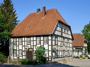
- Start: Princely forester's lodge Kreuzkrug
- Destination: Princely forester's lodge Kreuzkrug
Schlangen with the districts of Kohlstädt and Oesterholz - Haustenbeck offers a variety of landscapes and scenic hiking trails: heathland and sand dunes in the Senne, dry valleys in the Egge foreland, extensive forests between Kohlstädt and the Externsteine, wide views of the Senne and the Münsterland bay.
Attractive hiking destinations such as the Externsteine, Velmerstot and the Bad Lippspringe State Garden Show can be reached on hiking trails.
The town center around the town hall and the Protestant church offers refreshments in cafés and restaurants.
Good to know
Pavements
Best to visit
Tour information
Loop Road
Stop at an Inn
Directions & Parking facilities
Parking facilities
Fürstliches Forsthaus Kreuzkrug
Kreuzkrug 1, 33189 Schlangen
or at the hiking parking lot opposite
Additional information
License (master data)


