- 6:23 h
- 22.86 km
- 436 m
- 433 m
- 110 m
- 433 m
- 323 m
- Start: Schieder station
- Destination: Schieder station
The circular hiking trail Naturparktrail Nordteil offers a total of approx. 19 km of the varied nature and landscape of the Schwalenberg Forest. As an alternative to the train station, the parking lot at Schieder cemetery (Unter den Eichen) can be chosen as the starting point.
The Schwalenberg Forest with the Mörth forms around half of the approx. 4,000 ha forest area in the south-east of Lippe, which is one of the largest contiguous forest areas in the region.
The long and broad mountain ridge between Schieder and Schwalenberg with its beech, oak and spruce stands is criss-crossed by streams and ravines on the slopes and rises to 446 m above sea level. Its broad plateau is home to the "Mörth", whose name is derived from "Moor" and refers to the former raised bog.
250 years ago, the Mörth was still a bare swamp and heathland exposed to the interplay of wind, sun and moisture, which was reforested with conifers in later years. Even today, the boundary of the former Mörth moor - 43 hectares of which are under nature protection - is clearly visible in the landscape due to the transition from extensive beech high forest to spruce forest.
In order to make economic use of the moorland, efforts were made early on to drain the Mörth and use it for forestry. A brickworks also settled here towards the end of the 18th century, which used the peat to fire bricks, among other things. However, it ceased operations again around 1850.
The forestry offices created ponds in some places in order to be able to intervene more quickly or at all in the event of forest fires. One of these fire-fighting ponds is a popular stop-off point as a "water lily pond", as it is transformed into a floral gem in summer when the water lilies are in bloom.
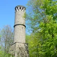
An important crossroads in the Schwalenberg forest is located at the birch hut. From here, it is worth making a detour to the Kahlenberg Tower, which was built in 1840/41 by the ruling house of Lippe as an addition to their summer residence, the castle and park at Schieder. The approx. 24 m high round tower made of quarry stone was erected on a square base. A spiral staircase inside the tower leads to the viewing platform. Following the afforestation of the Kahlenberg, which once lived up to its name, the view is now unfortunately limited. Nevertheless, a detour is worthwhile.
Not far from Schieder is the "Alt-Schieder" fortification - a clearing that is also popularly known as the Römerschanze. It consisted of two wall systems. The older fortification is probably from the early Middle Ages. Remains of the complex can be seen as a rampart and outer ditch in the forest. The younger fortification system encompassed the entire clearing. The castle had two gates. Excavation finds uncovered various strip foundations as well as the ground plan of a church and a cemetery. This royal court from the 11th century was attributed to the Archbishopric of Magdeburg until the noblemen of Lippe came into its possession. In 1484, they handed over the "Alter Hof zu Schieder" to the Augustinian monastery in Blomberg.
The path along the edge of the forest offers a particularly beautiful view of the landscape as far as the ridges of the Teutoburg Forest and the Eggegebirge mountains.
Waypoints
Good to know
Pavements
Best to visit
Tour information
Loop Road
Directions & Parking facilities
From Hanover via Hameln, Bad Pyrmont and Lügde to SchiederSee.
From Dortmund via Paderborn (B1) to Bad Meinberg and then towards Bad Pyrmont.
From Dortmund via Paderborn (B1) to Bad Meinberg and then towards Bad Pyrmont.
License (master data)
