


- 2:20 h
- 8.54 km
- 126 m
- 103 m
- 53 m
- 179 m
- 126 m
- Destination: Kirchberg hiking parking lot, Kirchbergstraße L961
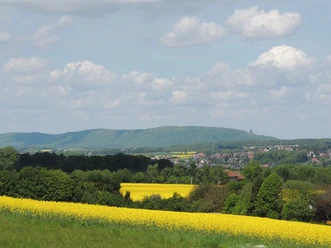
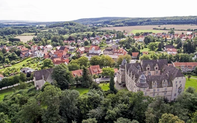
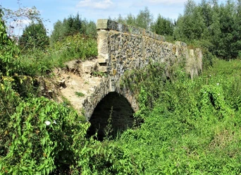
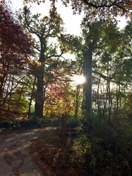
The Weserbergland view tour takes hikers to the very north of Kalletal. Through the Langenholzhausen forest, an impressive panoramic view of the Weserbergland opens up at Ringelbreite with a view of the Kaiser Wilhelm monument and Stemmer See lake. On the edge of the Weser floodplain is the Weser Renaissance castle of Varenholz with its Protestant Reformed church. Below the castle, the circular route leads through the Aberg-Herrengraben nature reserve past the old Herrengraben bridge dating from 1753. In the area of the Weser village of Erder, you walk through the beautifully landscaped and peaceful cemetery forest. Another natural monument can be discovered at Ihmser Bruch: Two approximately 250-year-old oaks are popularly known as the "Ihmser Tor" (Ihms Gate) due to their imposing appearance. The oaks are probably the oldest trees in the Weser floodplains on Lippe soil. At the following Bierhöhe, there is a scenic lounger for relaxing at a beautiful vantage point with a wide view.




Pavements
- Street (1%)Asphalt (12%)Gravel (3%)Trail (84%)
Best to visit
- suitableDepends on weather
Directions
- Start at the "Kirchberg" hiking parking lot: from here, head north. A viewpoint with seating awaits at the Rindelbreite. Cross the road at the "Felsenkeller" and pass the "Stein des Ostens" monument. Turn left here - past the panorama board of the "Weg der Blicke" (Path of Views) and down into the Peilesiedlung settlement of Varenholz. Via Varenholzer Straße, the trail leads across the parking lot of Varenholz Castle on the other side. Passing orchards, you reach the Beutebrink below the castle church. Here you now follow the Herrengraben, where the alternative route Weserradweg also runs along. At the campsite, the circular route now turns left, up to Erdersche Straße, which you cross. Up the path, turn left into the cemetery forest. At the end of the cemetery forest, the route turns left again to Biershöhe. Past the Ihmser Tor gate, keep left and then continue straight ahead in an easterly direction back to the starting point.
Route markings
- White television tower and Kaiser Wilhelm monument on a light blue background
Tour information
Cultural Interesting
Familiy-Friendly
Labelling
Loop Road
Directions & Parking facilities
- ParkingKirchberg hiking parking lot on the L961 between Langenholzhausne and Varenholz
Additional information
Short film about the Varenholz Castle Church monument: https://www.youtube.com/watch?v=0KFE7FIPRAI&feature=youtu.be
License (master data)
Gemeinde Kalletal

Author´s Tip / Recommendation of the author
- Take a look into the inner courtyard of the Weser Renaissance castle, which with its Protestant church, is located on the edge of the Weser floodplain. It looks back on a long history and is now home to a boarding school with a private secondary school.
Not far away, at the end of the Beutebrink, is the Weser, where you can take the Varenholz-Veltheim high-wire ferry across at weekends from April to October. Safety guidelines
- Two rescue points signposted along the route.
Map
Hiking map NRW: North Lippe Highlands
Kalletal hiking map